General Sargassum Information
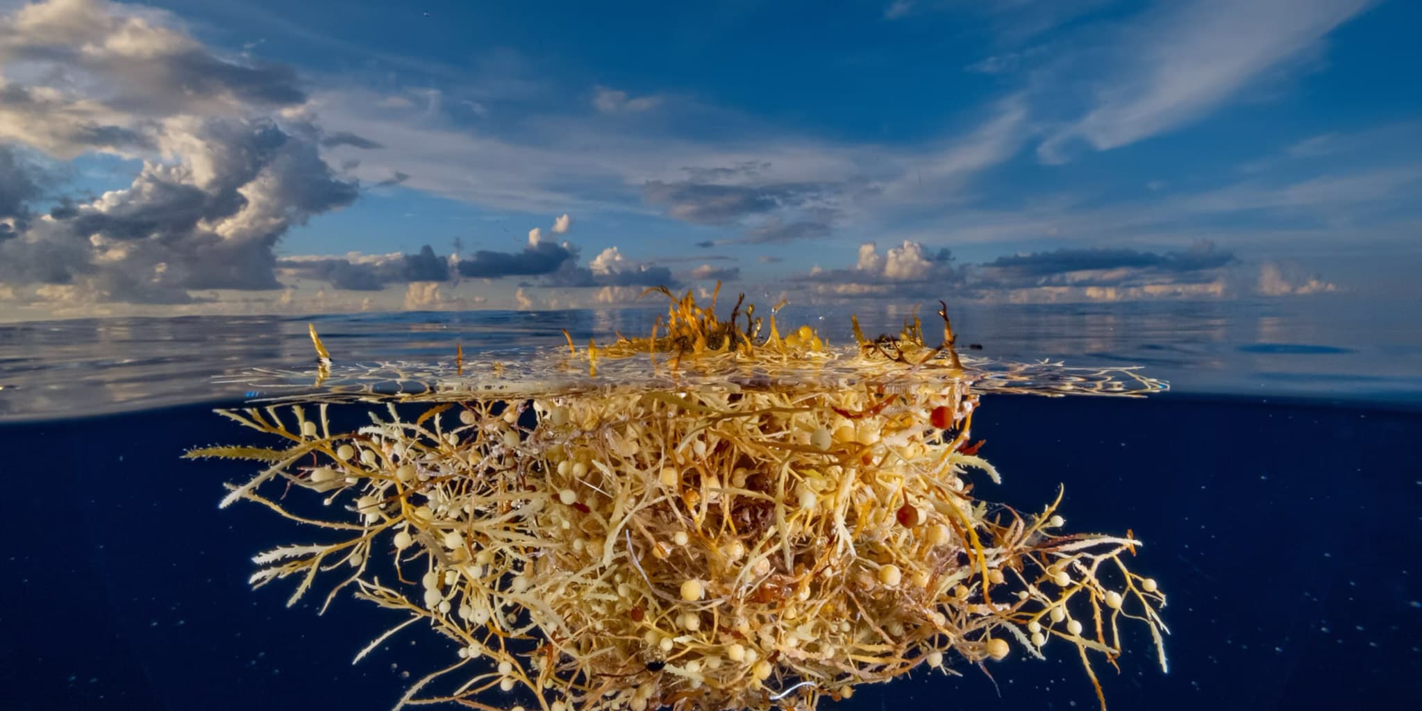
Sargassum is a type of brown floating seaweed that naturally drifts through the ocean, providing an important habitat for marine life but sometimes accumulating along coastlines in large amounts. In recent decades, sargassum has shifted its range — thinning out in the North Atlantic’s Sargasso Sea while expanding throughout the tropical Atlantic.
This trend, which began in 2011, continued in 2026, with the algae reaching its annual peak in June across the Great Atlantic Sargassum Belt and both the Caribbean Sea and Gulf of Mexico experiencing record-high levels.
That said, sargassum conditions can change week to week, so it’s best to check Belize forecasts, NOAA/AOML reports, and local operator updates before traveling — especially during peak season (June–October). Live maps and local forecasts are provided below to help you monitor conditions as your trip approaches.
Frequently Asked Questions
What is Sargassum?
Sargassum seaweed is a free-floating brown seaweed that originates in the Sargasso Sea and the equatorial Atlantic. Since 2011, a weather pattern shift has caused enormous quantities to wash into the Caribbean, including Belize’s coastline, each year. Because Belize sits along the Caribbean’s eastern-facing coastline, some beaches catch the seasonal drift while inland Belize remains completely unaffected.
- Sargassum blooms originate in the Atlantic’s Great Atlantic Sargassum Belt (GASB), which can stretch over 8,000 kilometres.
- It arrives in Belize through prevailing easterly winds and the North Atlantic Gyre current, with the heaviest impacts typically between June and October.
- When it accumulates on beaches, it decomposes and releases hydrogen sulfide and ammonia gases, creating a strong odor. Underwater, it remains harmless.
- The barrier reef provides protection for many inner-reef and lagoon areas. Mainland beaches facing east generally receive the most exposure, while leeward cayes and lagoon-side swimming areas are often clearer.
- Sargassum levels vary significantly each year. Checking current-season forecasts is recommended before planning beach-focused activities.
Where does Sargassum come from?
Historically, most Sargassum accumulated in the Sargasso Sea in the western North Atlantic, with smaller amounts found in the Gulf of Mexico and Caribbean Sea. In 2011, the geographic range expanded, and large quantities began moving west into the Caribbean Sea, Gulf of Mexico, and tropical Atlantic.
These floating mats have since reached coastal areas throughout the Caribbean, Florida, Puerto Rico, the U.S. Virgin Islands, and parts of Western Africa.
When is Sargassum season in Belize?
The main Sargassum season in Belize generally runs from March through October, with peak activity typically occurring between June and August. Conditions can change from week to week depending on ocean currents, wind patterns, and weather conditions.
For the most accurate information, travelers should monitor live Sargassum maps and local updates closer to their travel dates.
Which Belize Beaches Are Most Affected?
Sargassum exposure varies greatly depending on beach orientation, prevailing winds, and protection from Belize’s barrier reef.
- Ambergris Caye (San Pedro): Eastern beaches may experience moderate exposure, while western lagoon-side areas such as Secret Beach are generally clearer. Reef snorkeling remains unaffected.
- Caye Caulker: The Split and channel areas typically remain clear, while some eastern beaches may receive seasonal accumulation. Snorkeling sites like Hol Chan remain unaffected.
- Placencia: Southern beaches and the village coastline may experience more exposure. The Placencia Lagoon side is generally clearer, and offshore cayes are unaffected.
- Hopkins: Facing east-southeast, Hopkins can experience heavier accumulations during peak months. Pool access and inland activities provide excellent alternatives during heavy weeks.
- Cayo / San Ignacio: Completely unaffected. Rivers, waterfalls, caves, and jungle adventures provide a perfect alternative to coastal activities.
- Turneffe Atoll and Outer Cayes: Offshore reef areas are generally unaffected, as Sargassum typically concentrates closer to shore.
Why did the geographic range for Sargassum expand in 2011?
Since 2011, large Sargassum accumulations have occurred annually throughout the Caribbean Sea, Gulf of Mexico, and tropical Atlantic, although the amount varies from year to year.
Sargassum does not form a continuous blanket across the ocean. Instead, it floats in patches ranging from a few centimeters to hundreds of meters wide. Some patches eventually reach coastal areas, affecting beaches, ports, and water intake systems.
Satellite monitoring allows researchers to estimate Sargassum coverage and track changes in volume and distribution across affected regions.
What are the benefits of Sargassum to ocean ecosystems?
In the open ocean, Sargassum provides an important habitat for fish, sea turtles, and many other marine organisms. However, when large amounts reach shore, it can create challenges for coastal environments.
Accumulated Sargassum can smother coral reefs, seagrass beds, and beaches. As it decomposes, it produces hydrogen sulfide gas, creates odors, attracts insects, and may impact navigation, tourism activities, water systems, and coastal ecosystems.
What to Do When Sargassum Is Bad?
A Sargassum day doesn’t have to mean a wasted day. Whether you’re staying at one of our beach resorts or exploring the jungle, Belize offers plenty of ways to turn the day into an adventure.
Swap the shoreline for an inland experience like the ATM Cave, where you’ll explore an ancient Maya cave system on a full-day guided tour with no seaweed in sight. From jungle adventures and cultural experiences to coastal excursions, our resorts offer a variety of tours to make the most of your Belize getaway. Explore our tours and find your next adventure.
- Relax by the Resort Pool: Enjoy a pool day at Umaya Resort & Adventure, Blue Reef Resort, or The Lodge at Jaguar Reef when you purchase food or drinks. Jaguar Reef’s Big Dock, featuring a pier bar and rope swing over the water, is also accessible to dining guests. A manatee was spotted there as recently as March 2026.
- Explore the Belize Barrier Reef: Sargassum typically accumulates closer to shore rather than over open reef areas. A 20–40 minute boat ride to Hol Chan, Silk Cayes, or Shark Ray Alley offers crystal-clear water, vibrant coral, and incredible marine life.
- Swim in Belize’s Rivers: Escape the coastline and enjoy refreshing freshwater swimming at the Sittee River in Hopkins, Sibun River Valley near Belmopan, or the Macal River in San Ignacio.
- Cave Tubing & Jungle Adventures: Explore Belize’s inland wonders with a visit to the ATM Cave, cave tubing at Nohoch Che’en, or a waterfall hike at Five Blues Lake. These jungle experiences are unaffected by coastal sargassum conditions. Tours can be booked through The Rainforest Lodge at Sleeping Giant or The Banks Resort.
- Kayak the Lagoon: Paddle through calm, protected waterways like the Placencia Lagoon and the Hopkins/Sittee River mouth. These areas remain sargassum-free, and many resorts offer complimentary kayaks.
- Take a Day Trip to the Cayes: If mainland beaches are experiencing heavier sargassum, a water taxi to Tobacco Caye or a charter to the Silk Cayes provides pristine reef beaches and clear Caribbean waters in under an hour.
Ready to Plan Your Adventure?
Contact our Reservations Team to book your tour today.
Further Reading
Related Resources
-
Belize Sargassum Map — Belize Travel Insider
View Live Sargassum Map -
Satellite-Based Sargassum Watch System (SaWS) — NOAA AOML Coastwatch Caribbean/Gulf of Mexico
View Sargassum Inundation Risk Map -
Sargassum Forecast — Belize National Meteorological Service
View Belize Sargassum Forecast -
Sizing Up the Sargassum Belt — NASA Earth Observatory
Read NASA's Sargassum Overview
AOML Sargassum Publications
Trinanes, J., N.F. Putman, G. Goni, C. Hu, and M. Wang. (2023).
Monitoring pelagic Sargassum inundation potential for coastal communities.
Journal of Operational Oceanography, 16(1):48-59.
View Publication
Andrade-Canto, F., F.J. Beron-Vera, G.J. Goni, D. Karrasch, M.J. Olascoaga, and J. Trinanes. (2022).
Carriers of Sargassum and mechanism for coastal inundation in the Caribbean Sea.
Physics of Fluids, 34(1):016602.
View Publication
Beron-Vera, F.J., M.J. Olascoaga, N.F. Putman, J. Trinanes, G.J. Goni, and R. Lumpkin. (2022).
Dynamical geography and transition paths of Sargassum in the tropical Atlantic.
AIP Advances, 12(10):105107.
View Publication
Trinanes, J., C. Hu, N.F. Putman, M.J. Olascoaga, F.J. Beron-Vera, S. Zhang, and G.J. Goni. (2021).
An integrated observing effort for Sargassum monitoring and warning in the Caribbean Sea, tropical Atlantic, and Gulf of America.
Oceanography 34(4):68-69.
View Publication
Miron, P., M.J. Olascoaga, F.J. Beron-Vera, N.F. Putman, J. Trinanes, R. Lumpkin, and G.J. Goni. (2020).
Clustering of marine debris- and Sargassum-like drifters explained by inertial particle dynamics.
Geophysical Research Letters, 47(19).
View Publication
Putman, N., R. Lumpkin, M.J. Olascoaga, J. Trinanes, and G.J. Goni. (2020).
Improving transport predictions of pelagic Sargassum.
Journal of Experimental Marine Biology and Ecology, 529:151398.
View Publication
Johns, E.M., Lumpkin, R., Putman, N.F., Smith, R.H., Muller-Karger, F.E., Rueda-Roa, D., Hu, C., Wang, M., Brooks, M.T., Gramer, L.J., & Werner, F.E. (2020).
The establishment of a pelagic Sargassum population in the tropical Atlantic: Biological consequences of a basin-scale long distance dispersal event.
Progress in Oceanography, 182, 102269.
View Publication
Putman, N.F., G.J. Goni, L.J. Gramer, C. Hu, E.M. Johns, J. Trinanes, and M. Wang. (2018).
Simulating transport pathways of pelagic Sargassum from the equatorial Atlantic into the Caribbean Sea.
Progress in Oceanography, 165:205-214.
View Publication